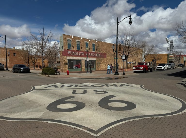
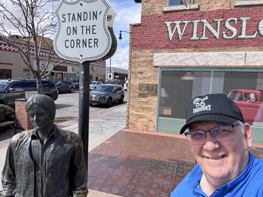
On Thursday (March 14th), we left Holbrook, AZ and drove west across the northern Arizona, toward our next major detination: Death Valley National Park. But, first we had to stop at Winslow, AZ so Steve could get some selfies at the famous Standing On The Corner Park.
The lyrics to the Eagles first hit, "Take It Easy" mentions "...standing on the corner in Winslow, Arizona..."
So, of course, Steve has to stand on the corner with Jackson Brown, (co-author with the Eagle's Glen Fry).
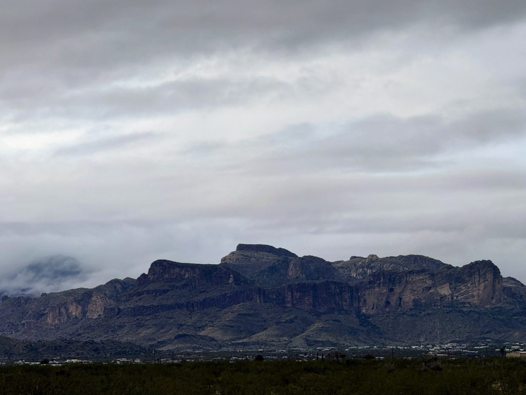
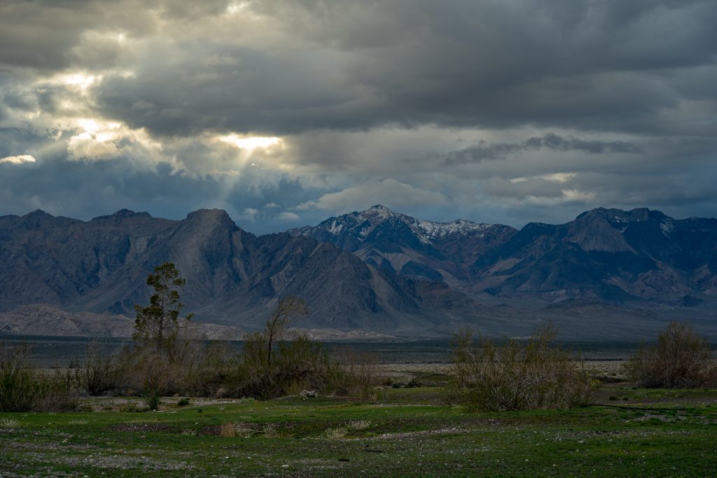
Next, we drove through snow showers as we crossed through Flagstaff. Hard to believe that there was snow on the ground in Arizona, especially since we haven’t seen snow in Wisconsin for over a month. Crazy weather. We drove to Golden Valley, AZ and stopped for the night. Friday (March 15th) we drove over the Black Mountain range, through Laughlin and north through Las Vegas. No gambling on this trip. The only money we dropped in Vegas was for a tank of diesel and a few supplies. Next we headed Northwest on Hwy 95 through a section of beautiful, southwest scenery. It rained much of the day, but started to clear as we stopped for the night in Amargosa Valley, NV (near the California border). This positioned us close to entrance for Death Valley National Park.
Friday morning started out drab and rainy at our site in Golden Valley, Arizona.
After raining most of the day, we were glad to see some rays of sunshine when we reached Amargosa Valley, NV.
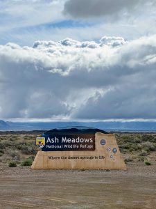
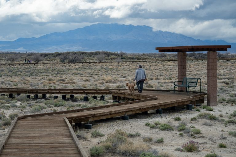
Before heading into Death Valley, we drove to the Ash Meadows Wildlife Refuse on Saturday morning (March 16th), to check out the largest oasis in the Mojave Desert. We hiked along the boardwalk loop to see mountain vistas and a series of natural springs that harbors endemic species, including the Ash Meadows Pupfish (a small, playful fish adapted only to these desert springs).
This wildlife refuge was close to our overnight stop and recommended by another camper.
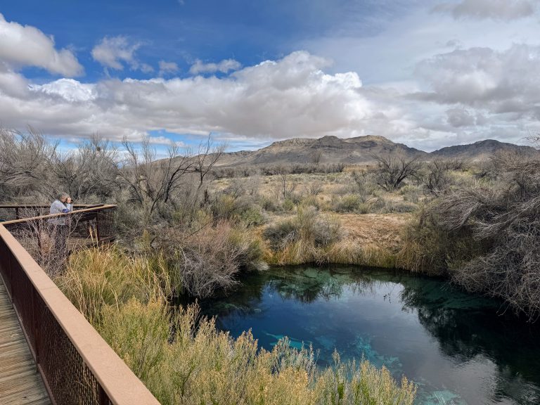
We took the boardwalk hike through the desert to one of the crystal clear springs.
This photo doesn't show the minnow-sized pupfish, but we enjoyed watching them dart around in the spring.
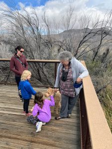
Lucy loved the hike on the boardwalk. She made many new friends!
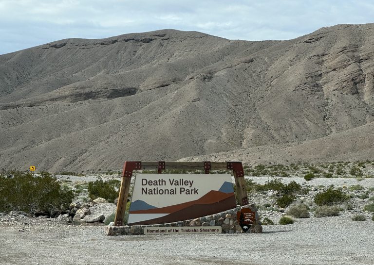
We crossed the state line into California and headed into Death Valley National Park. We had imagined this area to be a large, low-lying, flat salt bed in the middle of a vast desert. We were surprised to see such a wide variety of landscapes, including mountains, badlands, a rare lake and many other geological features. Death Valley is so much more than just salt flats. The park includes the Amargosa Mountains to the east and the Panamint Mountains to the west. The high mountain ranges on either side trap the air and retain the heat in the below sea level valley, creating the famously high summer temperatures. This is the largest National Park, outside of Alaska.
We made it to our 2nd National Park of this trip, and were surprised to see so many hills and mountains.
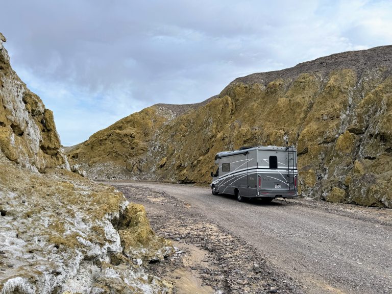
We took a narrow, one-way dirt road side-trip through 21 Mule Canyon, which features badlands.
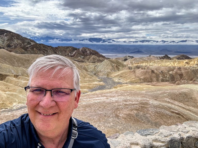
A short walk to Zabriskie Point offers outstanding views of the two mountain ranges with Death Valley below.
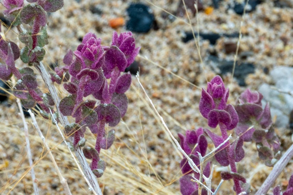
We saw limited wildflowers as we drove through the southeast part of the park.
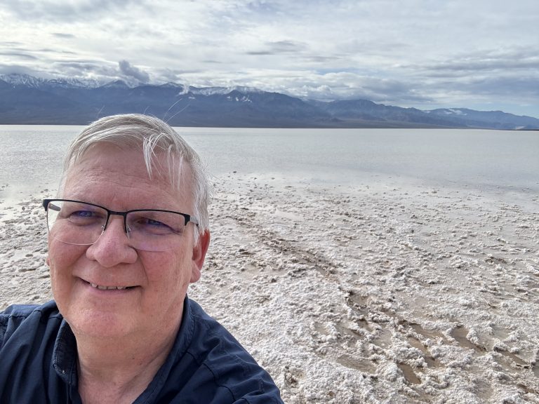
We spent most of the day on Saturday slowly working our way through the main stopping points in this unique National Park. Of course, the main feature of the park is the Badwater region, near Furnace Creek, which drops to the lowest spot in North America (282 feet below sea level). For the first time in 19 years, this area was covered with water, creating the rarely-seen Manly Lake. We stopped for the night at one of the many campgrounds inside of the park.
Visitors can walk out onto the salt flats and get a close look at the rare lake.
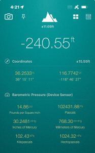
This was the lowest spot that we were able to find, according to Laurie's iPhone app.
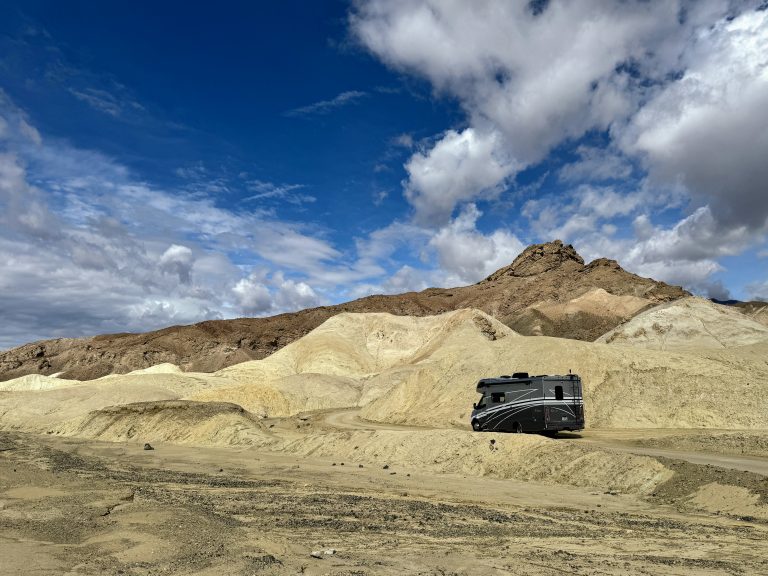
We also drove through Mustard Canyon, which...you guessed it...is yellow colored.
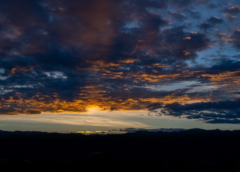
We reached our campsite at Stovepipe Wells just in time to see the sunset over the Panamint mountains.
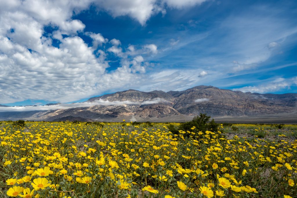
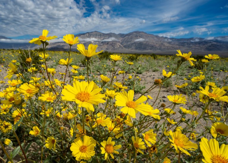
Sunday morning we drove West on Hwy 190 into Panamint valley, which is just west of Death Valley. This valley is also hot and low, but not as hot and low as it’s famous next door neighbor. As we reached the valley floor, there was a tremendous display of wildflowers.
Wide sections of the Panamint Valley were full of these small yellow wildflowers called Desert Sunflowers.
There was only one type of wildflower in bloom, but the views were still amazing.
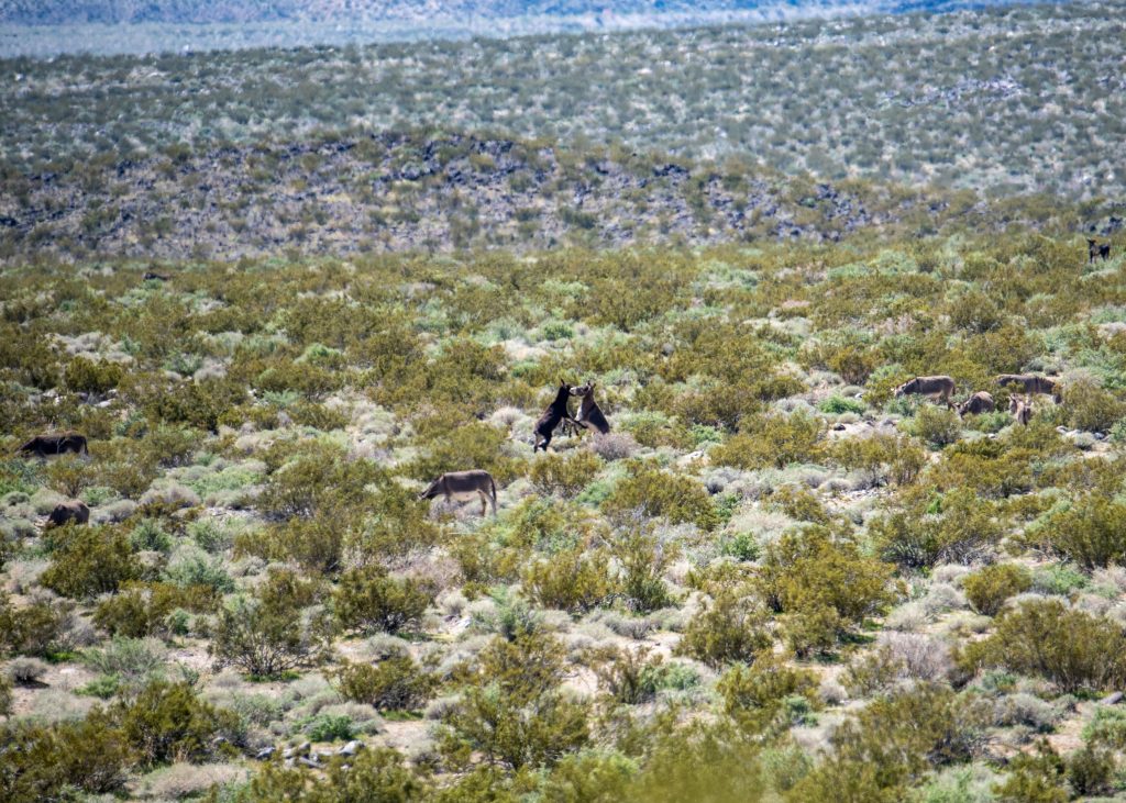
As we drove further south, Laurie suddenly noticed wild burros out in the desert. A few crossed the road right in front of our RV. We were told it is rare to see burros in the wild. They were originally brought into this area in the 1800’s to help miners carry supplies or haul out minerals. Some escaped or were abandoned as miners left their claims. However, they are harmful to the delicate desert ecosystem, so the park service has been rounding them up for decades.
We saw a group of at least 7 or 8 wild burros in the distance. Notice the ones in the middle that are fighting!
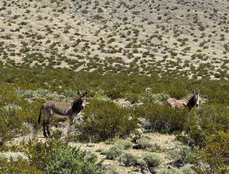
These two looked curiously at the RV when they heard Lucy barking. She really wanted to go play with them!
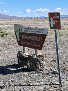
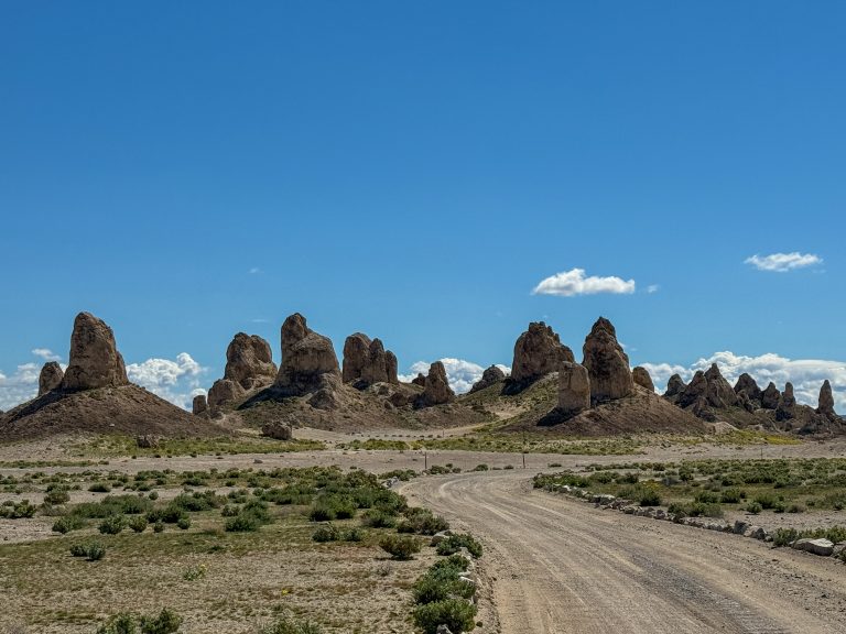
We drove out of the park and through Trona, CA, an industrial town where minerals are extracted from Searles Lake. Laurie suggested we drive out to see the Trona Pinnacles. The 5 mile drive down a rugged dirt road was well worth it. There are more than 500 rock formations called Tufa Spires. Some are as high as 140 feet. These rock formations were created tens of thousands of years ago when the level of nearby Searles Lake dropped and then erosion wore away the surrounding sediment.
This remote park offers views of these unique pinnacles (you can see them in the distance beyond the sign).
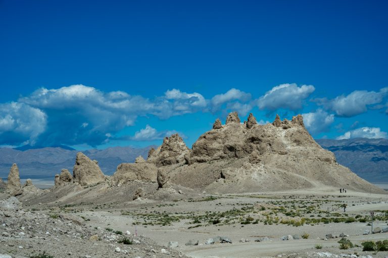
These calcium carbonate spires rise up more than 140 feet above the valley floor.
To get a sense of scale, look carefully in the lower right, near the base of the pinnacle to see some people hiking.
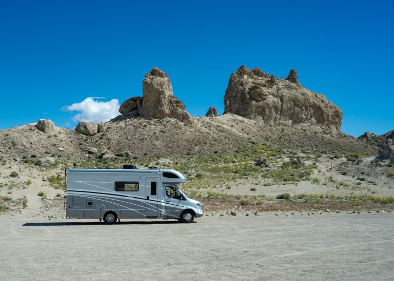
Earl (our RV) got quite a workout as we traveled the dirt road out to this park, but we're glad we made the trip.
We stopped for the night in Ridgecrest, CA, which is the town that supports the China Lake Naval Base. Over the next few days we will visit Sequoia National Park, King’s Canyon National Park and Yosemite National Park. So, stay tuned for another post soon!
Sign up to be notified by email of all new posts on funwithaview.com. We promise to never sell or misuse your personal information. We wouldn’t do that to you. Besides, we have no idea how to do that anyway!
1 thought on “Death Valley”
James
We love the blog! Inquiring minds want to know what’s next.

We love the blog! Inquiring minds want to know what’s next.